About US

Delivering Reliable Digital Engineering Solutions Across Every Project Stage

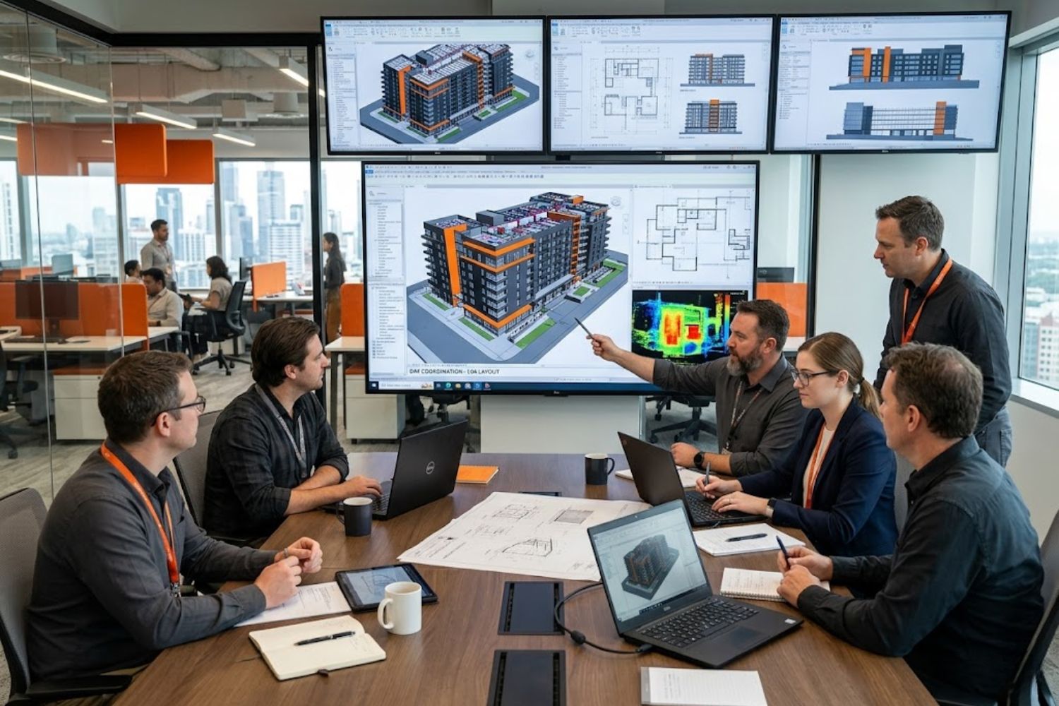
Aaira 3D helps architects, engineers, consultants, and project teams transform point cloud and survey data into accurate BIM models, CAD drawings, GIS deliverables, and technical documentation. Our focus is on creating dependable digital assets that improve project planning, coordination, and decision-making across residential, commercial, infrastructure, and industrial sectors.
Why Choose Aaira 3D

We convert survey and scan data into precise digital deliverables for smarter, faster project execution

0 +

Projects Delivered

Successfully completed across residential, commercial, infrastructure, and industrial sectors.
0 +

Years of Experience

Trusted expertise in point cloud modeling, BIM, CAD, and digital engineering solutions.
0 %

Modeling Accuracy

High-precision BIM, CAD, and as-built deliverables that reduce project errors.
+

Global Clients Served

Trusted by businesses worldwide for accurate digital engineering and documentation solutions.
OUR COMMITMENT

Quality Assurance, Reliable Delivery & Transparent Project Execution

At Aaira 3D, every project is built on accuracy, consistency, and dependable delivery. Our structured workflows ensure that all BIM models, CAD outputs, GIS data, and as-built documentation meet the highest standards of quality while aligning with your project scope, timeline, and technical requirements.

Rigorous Quality Assurance (QA/QC)

Every deliverable is carefully verified to ensure accuracy, compliance, and dependable final project outputs.

Reliable Delivery & Timelines

We maintain efficient schedules and clear timelines to ensure smooth, predictable project completion.

Consultative Project Planning

Every project starts with strategic consultation to define goals, scope, and technical requirements.

Transparent Communication

Regular updates and collaborative support ensure clarity, trust, and aligned project success.
WHAT YOU RECEIVE

Industry-Ready Digital Deliverables

Aaira 3D delivers professional BIM, CAD, GIS, and technical documentation outputs compatible with modern engineering and project workflows.

Scan to BIM

REVIT, IFC, and CAD-ready BIM deliverables for coordination, planning, and facility workflows.

Scan to 3D CAD Models

3D CAD, IFC, STEP, and SAT outputs compatible with major engineering and design platforms.

Scan to 2D Drawings

2D drawings and print-ready PDF files prepared for documentation and project execution.

Ready to Turn Your Survey Data into Actionable Digital Deliverables?

Partner with Aaira 3D for accurate BIM models, CAD drawings, GIS solutions, and project-ready documentation tailored to your requirements.